|
Scaling and compressing the actual site to fit in a limited space.
Read here about the process to create the layout using real maps to get an accurate result compared to the real world as possible.
The site: Tehachapi Loop
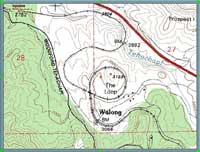
To find the data for the site, a map need to be found. I used maps from TopoZone, and also found a satteliteimage from USGS, on their website. The actual map and image can be found here.
Topozone Maps, the source for the original map on Tehachapi Loop
Link for map on Tehachapi Loop:
http://www.topozone.com/tehachapi
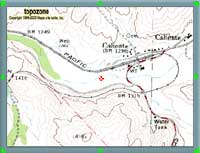
Link for map on Caliente.
This is another very interesting spot to model, with a horseshoe curve, a few miles from the loop: http://www.topozone.com/caliente This may be the next spot to model.
All maps are copyright Topozone http://www.topozone.com
Sateliteimages from USGS
|
The development of the Tehachapi Loop trackplan i Z-scale
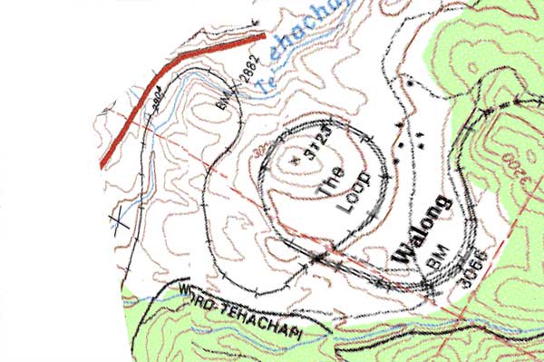
Step 1: The actual part that shall be modelled, is rotated so it fits the layout space.

The original map found on TopoZone
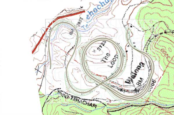
Step 2: The map is compressed and warped on the left part and the tunnel after Walong is rotated a little. It results in a shorter layout and fits the space available for the layout. Because of the warping of the original map, the contour lines is also warpet, so the countur lines can be used to construct the terrain and that it will look similar in the model, as in the original world. Hopefully you can still have the feeling of Tehachapi Loop when you look at the plans, and later at the layout.
The compressed and warped map
Step 3: The layout is constructed in 3rd Plan It. The scale is not correct, because of the limited space to be used on the layout.
The track design and the contour lines is taken from the original map, to create the layout as accurate as possible, compared to the real world.
Layout on top of the compressed and warped map
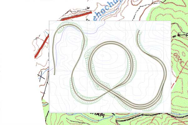
Layout on top of the compressed and warped map
Step 4: The contour lines for the terrain is constructed from the map. The cut and fill is constructed by looking at photos, to try to get an overall feeling that this layout is Tehachapi Loop.
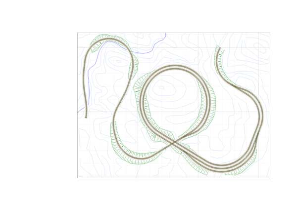
The Tehachapi Layout in Z-scale
|